Stretching 150 miles across mountains and rivers, lined with electric fences and landmines, the Korean Demilitarized Zone is one of the most fortified borders on Earth. But this tense strip didn’t appear overnight—its roots run deep into centuries of conflict and foreign ambition.

For over a thousand years, Korea existed as a unified kingdom, isolated enough to earn the nickname “Hermit Kingdom.” That peace shattered in the early 1900s, when rival empires treated the peninsula as a chessboard. Japan won the Russo-Japanese War, seized Korea, and ruled it brutally until its defeat in World War II.
What followed was not freedom, but division.
With Japan gone, the U.S. and USSR rushed to decide Korea’s fate. Two American officers, under intense time pressure, drew a line across a map—the 38th parallel—never imagining it would define generations. The Soviets took the north, the Americans the south, and soon two rival governments emerged, each claiming to represent all Koreans.
In 1950, the fragile balance collapsed. North Korean troops crossed the 38th parallel, igniting a devastating war that killed millions and pulled in global powers. When the fighting finally halted in 1953, there was no peace—only a ceasefire.
Both sides stepped back a mile, leaving a 2.5-mile-wide buffer zone: the DMZ. Paradoxically “demilitarized,” it remains bristling with weapons and tension—a frozen reminder of a border drawn in haste and a war that never officially ended.
Location:The Korean Demilitarized Zone intersects but does not follow the 38th parallel north, which was the border before the Korean War. It crosses the parallel on an angle, with the west end of the DMZ lying south of the parallel and the east end lying north of it.The DMZ is 250 km (160 mi) long, approximately 4 km (2.5 mi) wide. Though the zone itself is demilitarized, the zone’s borders on both sides are some of the most heavily militarized borders in the world The Northern Limit Line, or NLL, is the disputed maritime demarcation line between North and South Korea in the Yellow Sea, not agreed in the armistice. The coastline and islands on both sides of the NLL are also heavily militarized.
Flagpoles:In the 1980s, the South Korean government built a 100 m (328 ft) flag pole in Daeseong-dong, which flies a South Korean flag weighing 130 kg (287 lb). The North Korean government responded by building the 160 m (525 ft) Panmunjeom flagpole in Kijŏng-dong, only 1.2 km (0.7 mi) west of the border with South Korea. It flies a 270 kg (595 lb) flag of North Korea. In 2014, the Panmunjeom flagpole was the fourth tallest in the world, after the Jeddah Flagpole in Jeddah, Saudi Arabia, at 170 m (558 ft), the Dushanbe Flagpole in Dushanbe, Tajikistan, at 165 m (541 ft) and the pole at the National Flag Square in Baku, Azerbaijan, which is 162 m (531 ft). It is currently the world’s seventh largest flagpole.
DMZ-related incidents and incursions:Since demarcation, the DMZ has had numerous cases of incidents and incursions by both sides, although the North Korean government typically never acknowledges direct responsibility for any of these incidents (there are exceptions, such as the axe incident).This was particularly intense during the Korean DMZ Conflict (1966–1969) when a series of skirmishes along the DMZ resulted in the deaths of 81 American, 299 South Korean and 397 North Korean soldiers. This included the Blue House Raid in 1968, an attempt to assassinate South Korean President Park Chung Hee at the Blue House.In 1976, in now-declassified meeting minutes, U.S. deputy secretary of defense William Clements told U.S. secretary of state Henry Kissinger that there had been 200 raids or incursions into North Korea from the south, though not by the U.S. military. Details of only a few of these incursions have become public, including raids by South Korean forces in 1967 that had sabotaged about 50 North Korean facilities.
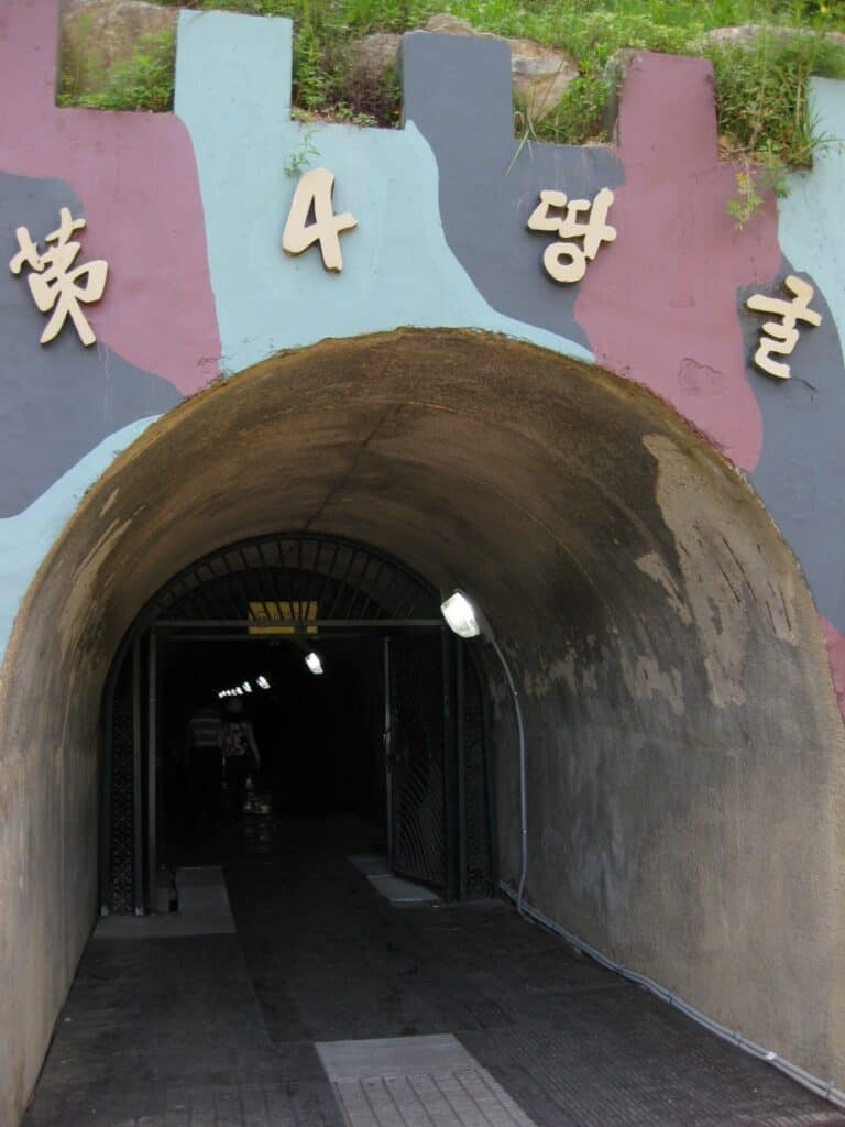
Incursion tunnels: Since 15 November 1974, South Korea has discovered four tunnels crossing the DMZ that had been dug by North Korea. The orientation of the blasting lines within each tunnel indicated they were dug by North Korea. North Korea claimed that the tunnels were for coal mining; no coal was found in the tunnels, which were dug through granite. Some of the tunnel walls were painted black to give the appearance of anthracite.The tunnels are believed to have been planned as a military invasion route by North Korea. They run in a north–south direction and do not have branches. Following each discovery, engineering within the tunnels has become progressively more advanced. For example, the third tunnel sloped slightly upwards as it progressed southward, to prevent water stagnation. Today, visitors from the south may visit the second, third and fourth tunnels through guided tours.
First tunnel:The first of the tunnels was discovered on 15 November 1974, by a South Korean Army patrol, noticing steam rising from the ground. The initial discovery was met with automatic fire from North Korean soldiers. Five days later, during a subsequent exploration of this tunnel, US Navy Commander Robert M. Ballinger and ROK Marine Corps Major Kim Hah-chul were killed in the tunnel by a North Korean explosive device. The blast also wounded five Americans and one South Korean from the United Nations Command.
The tunnel, which was about 0.9 by 1.2 m (3 by 4 ft), extended more than 1 km (1,100 yd) beyond the MDL into South Korea. The tunnel was reinforced with concrete slabs and had electric power and lighting. There were weapon storage areas and sleeping areas. A narrow-gauge railway with carts had also been installed. Estimates based on the tunnel’s size suggest it would have allowed considerable numbers of soldiers to pass through it.
Second tunnel:The second tunnel was discovered on 19 March 1975. It is of similar length to the first tunnel. It is located between 50 and 160 m (160 and 520 ft) below ground, but is larger than the first, approximately 2 by 2 m (7 by 7 feet).
Third tunnel:The third tunnel was discovered on 17 October 1978. Unlike the previous two, the third tunnel was discovered following a tip from a North Korean defector. This tunnel is about 1,600 m (5,200 ft) long and about 73 m (240 ft) below ground.Foreign visitors touring the South Korean DMZ may view inside this tunnel using a sloped access shaft.
Fourth tunnel:A fourth tunnel was discovered on 3 March 1990, north of Haean town in the former Punchbowl battlefield. The tunnel’s dimensions are 2 by 2 m (7 by 7 feet), and it is 145 m (476 ft) deep. The method of construction is almost identical in structure to the second and the third tunnels.
Neutral Zone of the Han River Estuary:The whole estuary of the Han River is deemed a “Neutral Zone” and is off-limits to all civilian vessels and is treated like the rest of the DMZ. Only military vessels are allowed within this neutral zone.According to the July 1953 Korean Armistice Agreement civil shipping was supposed to be permissible in the Han River estuary and allow Seoul to be connected to the Yellow Sea (West Sea) via the Han River. However, both Koreas and the UNC failed to make this happen. The South Korean government ordered the construction of the Ara Canal to finally connect Seoul to the Yellow Sea, which was completed in 2012. Seoul was effectively landlocked from the ocean until 2012. The biggest limitation of the Ara Canal is it is too narrow to handle any vessels except small tourist boats and recreational boats, so Seoul still cannot receive large commercial ships or passenger ships in its port.
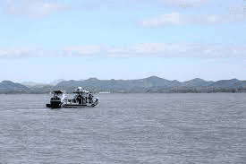
In recent years Chinese fishing vessels have taken advantage of the tense situation in the Han River Estuary Neutral Zone and illegally fished in this area due to both North Korean and South Korean navies never patrolling this area due to the fear of naval battles breaking out. This has led to firefights and sinkings of boats between Chinese fishermen and South Korean Coast GuardOn January 30, 2019, North Korean and South Korean military officials signed a landmark agreement that would open the Han River Estuary to civilian vessels for the first time since the Armistice Agreement in 1953. The agreement was scheduled to take place in April 2019 but the failure of the 2019 Hanoi Summit indefinitely postponed these plans.
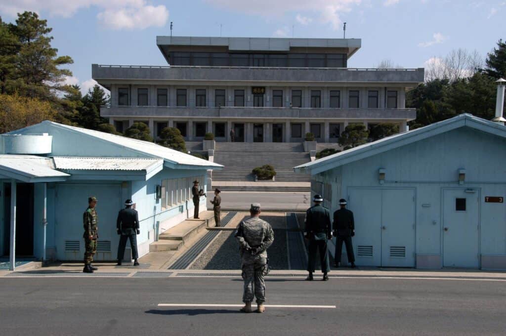
Presence of landmines and Korean War remains:On 1 October 2018, North and South Korean military engineers began a scheduled 20 day removal process of landmines and other explosives planted across the JSA.Work to remove landmines from the Joint Security Area was completed on 25 October 2018. Demining had begun at the DMZ’s Arrowhead Hill and resulted in the discovery of Korean War remains.Work between both Koreas to remove landmines from Arrowhead Hill was completed on 30 November 2018.
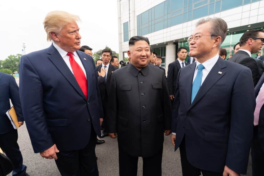
Meeting of Trump, Kim, and Moon at the DMZ: 2019 Koreas–United States DMZ SummitOn 30 June 2019, U.S. president Donald Trump became the first sitting U.S. president to enter North Korea, doing so at the DMZ line. After crossing into North Korea, Trump and North Korean chairman Kim Jong Un met and shook hands.Kim stated, in Korean, “It’s good to see you again”, “I never expected to meet you at this place” and “you are the first U.S. president to cross the border.” Both men then briefly crossed the border line before crossing back into South Korea.On the South Korean side of the DMZ, Kim, South Korean president Moon Jae-in, and Trump held a brief chat before holding an hour-long meeting at the DMZ’s Inter-Korean House of Freedom.
“The Lasting Scar of a Divided peninsula”:Today, the DMZ stands as a stark reminder of how decisions made in moments can shape generations. What began as an improvised line on a map—chosen in haste by foreign powers—became a permanent divide separating families, cultures, and ideologies. Yet the DMZ is more than a symbol of conflict. It represents Korea’s resilience, its struggle for identity, and its ongoing pursuit of peace.
Despite decades of tension, the hope for reunification has never fully faded. The Korean Peninsula, once a unified kingdom and later a battleground of global powers, continues to search for a future free of division. As long as the DMZ endures, it tells a story the world must not forget: that borders drawn without the voices of the people they affect can leave scars far deeper than the lines on a map.
Written By: Divya Kumari